Captured by the onboard HiRise camera, they show dramatic landscapes including inverted craters, deep water-forged gullies and frost covered dunes. To date, scientists have released 11,762 such images to the public.
They were sent back to Earth from the spacecraft, which is circling the Red Planet 72million miles away.
This week the orbiter broke through a major download milestone by passing the 100 terabytes of data mark. This is more than three times the amount of data collected from all other deep-space missions combined.
Just one terabyte is the equivalent of 300 hours of good quality video or 1,000 copies of the Encylopedia Britannica.
'What is most impressive about all these data is not the sheer quantity, but the quality of what they tell us about our neighbor planet,' said MRO Project Scientist Rich Zurek.
'The data from the orbiter's six instruments have given us a much deeper understanding of the diversity of environments on Mars today and how they have changed over time.'
The milestone comes as the orbiter completes its fourth year of operation. The spacecraft entered orbit around Mars on March 10, 2006, after it was launched on August 12, 2005, from Florida.
It completed its primary science phase in 2008 and continues investigations of Mars' surface, subsurface and atmosphere.
The orbiter sports a dish antenna 10 feet in diameter and uses it to pour data Earthward at up to 6 megabits per second. It has a number of instruments including three cameras - one of which is HiRise, a spectrometer for identifying minerals, a ground-penetrating radar and an atmosphere sounder.
The capability to return enormous volumes of data enables these instruments to view Mars at unprecedented spatial resolutions.
Half the planet has been covered at 20 feet per pixel, and nearly one per cent of the planet has been observed at one foot per pixel, sharp enough to discern objects the size of a desk.
The radar, provided by Italy, has looked beneath the surface in 6,500 observing strips, sampling about half the planet.
Among the mission's major findings is that the action of water on and near the surface of Mars occurred for hundreds of millions of years. This activity was at least regional and possibly global in extent, though possibly intermittent.
The spacecraft has also observed that signatures of a variety of watery environments, some acidic, some alkaline, increase the possibility that there are places on Mars that could reveal evidence of past life, if it ever existed.
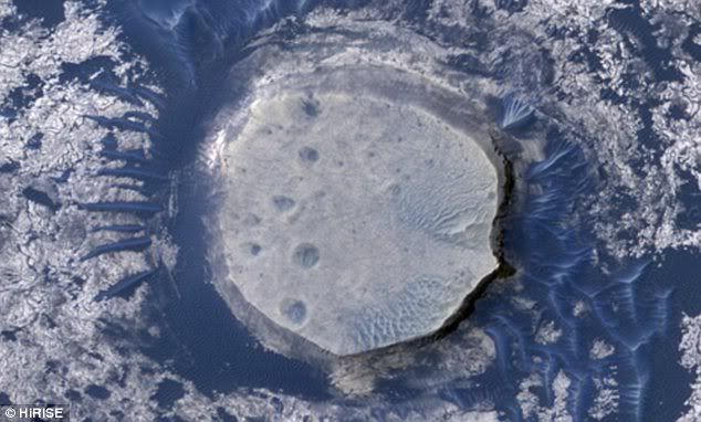
This image shows dark sand dunes and inverted craters in the Arabia Terra region of Mars. The sand is dark because it was probably derived from basalt. The 'inverted' shape is found on Mars and Earth where erosion has stripped away surrounding topography
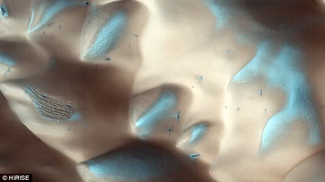
On the floor of this crater carbon dioxide ice forms an uninterrupted layer in winter. On the dunes however, dark streaks form as surface material from below the ice is mobilized and deposited on top of the ice
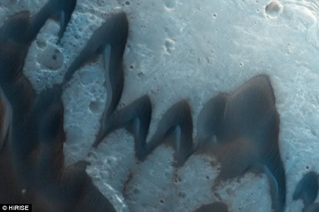
Barchan sand dunes that form in wind regimes that blow in one dominant direction. The ridged arcs of sand that define the barchan dunes end in horns that point downwind
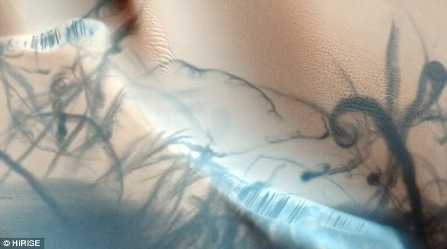
Sand dunes, with graceful blue-gray swirls caused by dust devils, which are like mini-tornadoes.
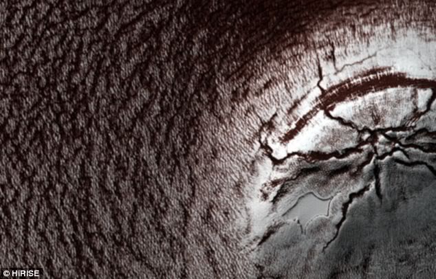
A thick (2mile) sequence of ice and dust, stacked like a layer cake, covers the south pole of Mars. Once ice begins to melt, darker dustier material is exposed.
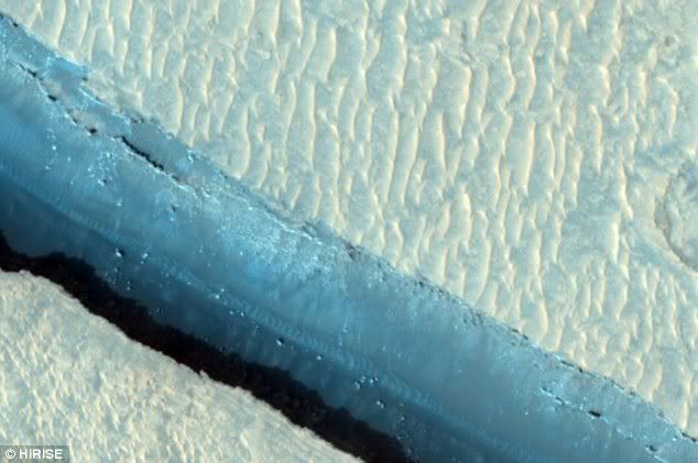
A branch of the Cerberus Fossae - a series of semi-parallel fissures on Mars formed by faults which pulled the crust apart in the region


